

Service Details
Web-GIS Application Development
Geospatial Datanabse Management Graphic Design Web-GIS Design and Development MarketingI specialize in developing robust Web-GIS applications that integrate geospatial data with user-friendly interfaces, enabling seamless visualization and analysis of geographic information. My services include geospatial database management, custom graphic design, and tailored Web-GIS solutions that optimize performance and enhance user experience. Additionally, I offer marketing strategies to help businesses effectively leverage their Web-GIS applications.
So far completed Web-GIS projects -
City Infrastuctures Monitoring and Management System.
Vehicle Tracking Systems.
Disaster Incidence Database.
4W Database for DRR.
Tsunami Tracking and Alerting System.
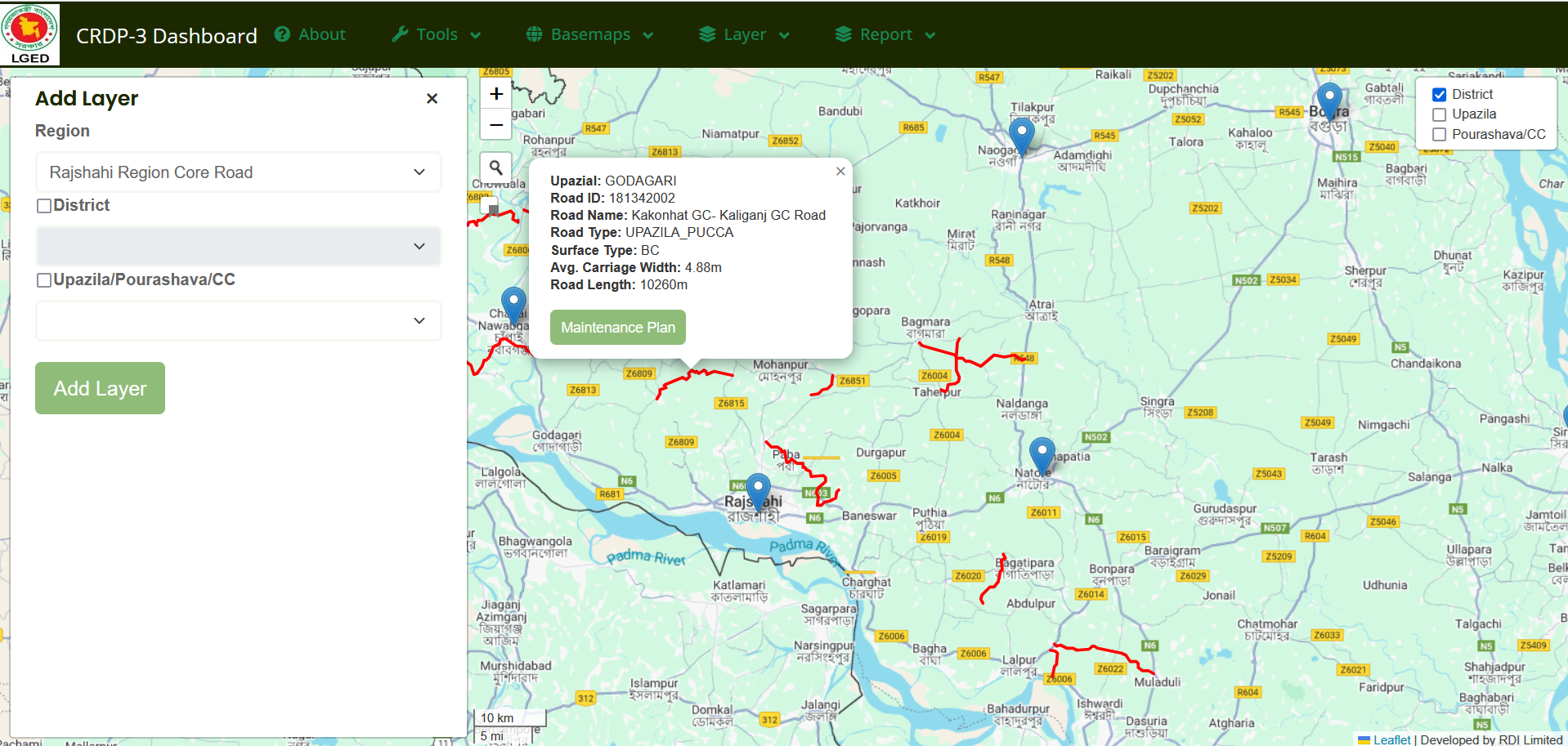
Road Safety Management System.
Each of these projects leverages Web-GIS technology to provide efficient, real-time solutions for various industries, enabling better decision-making and resource management.
1. Infrastructure Monitoring and Management System: A comprehensive Web-GIS solution designed to monitor and manage urban infrastructure. It helps in tracking the status, maintenance, and performance of critical infrastructure like roads, bridges, utilities, and more, enabling efficient city planning and resource allocation.
2. Vehicle Tracking System: A real-time Web-GIS application that tracks vehicles, provides live updates, and visualizes their locations on a map. It helps improve fleet management, route optimization, and enhances security by offering real-time data to vehicle operators and managers.
3. Disaster Incidence Database: A Web-GIS application designed to collect, store, and analyze disaster-related data. It maps incidences like floods, earthquakes, and fires, helping authorities track events, predict potential hazards, and improve disaster response strategies.
4. 4W Database for Disaster Risk Reduction (DRR): This Web-GIS platform compiles and visualizes data related to Who, What, Where, and When of disaster management. It provides critical insights for planning and improving disaster risk reduction efforts, facilitating coordinated responses to emergencies.
5. Tsunami Tracking and Alerting System: A Web-GIS-based solution built to track tsunami threats in real-time. It integrates geospatial data and real-time monitoring systems to issue alerts, helping authorities take timely actions and ensure public safety in coastal areas.
6. Road Safety Management System: A Web-GIS tool to monitor and manage road safety data, including accident locations, traffic conditions, and infrastructure quality. It enables the identification of high-risk areas and supports road safety improvement initiatives, reducing accidents and nhancing public safety.